 Image 1 of 3
 Image 2 of 3
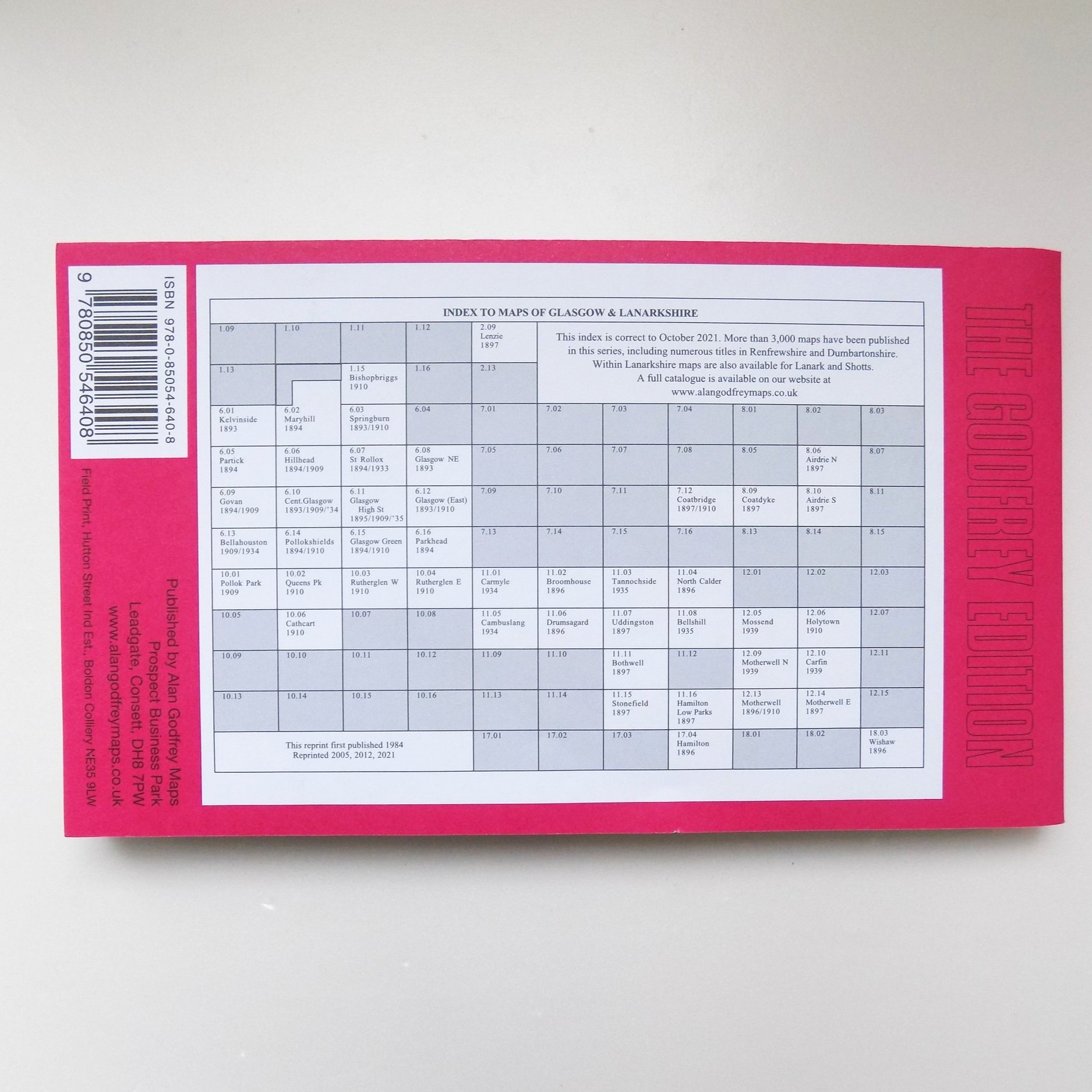 Image 3 of 3
Lanarkshire Sheet 6.02: Glasgow (Maryhill) 1894 – Published 1994; Introduction by Robin Urquhart
This detailed map encompasses a section of northwest Glasgow, featuring parts of Maryhill (top left), Wyndford, Eastpark, Ruchill, and Possil Park. At its centre lies Ruchill House, situated in an area experiencing rapid development in 1894.
Key features on the map include Ruchill Park, the Hamiltonhill Branch of the CR under construction, Firhill Iron Works, Western Saw Mills, Parkhouse Farm, and the Forth & Clyde Canal, along with the Glasgow Branch. Additional highlights are Phoenix Chemical Works, Tamshill, Gilshochill (top right corner), Maryhill Barracks, Lochburn Magdalene Institution, Maryhill Iron Works, various works along the canal, and Kelburn Park.
The reverse side of the map includes a section of the adjacent map 1.14, extending coverage northward to include Lambhill, part of Possil Loch, Kenmure Row, Lambhill House, Western Necropolis, St Kentigern's RC Cemetery, and an additional stretch of the Forth & Clyde Canal.